
Las Vegas is not one place – it’s a collection of distinct neighborhoods, master-planned communities, and unincorporated areas spread across the Mojave Desert. Most visitors see only the Strip, but the metro is home to 2.2 million people living in communities with their own character, restaurants, outdoor recreation, and retail. This guide explains every major area of the Las Vegas metro, what each offers, how far it is from the Strip, and how to get between them.
Las Vegas at a Glance ·
The Metro Map ·
The Strip (Paradise) ·
Downtown / Fremont ·
Paradise & the Airport ·
Summerlin ·
Henderson ·
North Las Vegas ·
Enterprise ·
Spring Valley ·
Where to Stay ·
Getting Around ·
Related Resources ·
Quick-Reference Table ·
FAQs
- The Las Vegas Valley holds ~2.2 million people across ~640 square miles – the 29th-largest U.S. metro – not a single city.
- Most of the famous Strip is not in the city of Las Vegas at all – it sits in unincorporated Paradise, NV (Clark County).
- Mid-Strip is best for first-timers; near the Convention Center for business travelers; Summerlin or Henderson for a quieter, residential base.
- Summerlin (NW, ~12 mi) and Henderson (SE, 12-15 mi) are the two big master-planned communities; Enterprise (SW) holds Allegiant Stadium.
- The valley is a driving metro – transit is limited and neighborhoods aren’t walkable to each other, so plan transportation between areas.

Las Vegas at a Glance
The single most useful thing to understand about Las Vegas is that “Las Vegas” the tourist destination and “Las Vegas” the incorporated city are not the same thing. The resort corridor most people picture sits in unincorporated Clark County, while the metro stretches far beyond it across the valley floor.
Population: ~2.2 million (metro) · 29th-largest U.S. metro
Land area: ~640 square miles (valley)
Core cities: Las Vegas, Henderson, North Las Vegas
Major unincorporated areas: Paradise, Enterprise, Spring Valley
Strip length: ~4.2 miles (Mandalay Bay to Encore)
Approximate driving miles from the center of the Strip. Source: PSS dispatch routing data, 2026.
For service coverage across the whole valley, see our local transportation service.
Book Transportation Anywhere in Las Vegas
The Las Vegas Metro Map
The map below shows the Las Vegas Valley so you can orient the neighborhoods covered in this guide – the Strip and downtown in the center, Summerlin to the northwest, Henderson to the southeast, North Las Vegas to the north, and Enterprise and Spring Valley to the southwest and west.
The Las Vegas Strip — Paradise, NV
What the world calls the “Las Vegas Strip” is technically in Paradise, Nevada – an unincorporated community in Clark County, not the city of Las Vegas. The Strip runs about 4.2 miles along Las Vegas Boulevard South from Mandalay Bay (south) to Encore/Wynn (north), holding the highest concentration of large resort hotels, entertainment venues, restaurants, and casinos in the world.
The Las Vegas Strip
Location: Las Vegas Blvd S, Paradise, NV 89109

Strip geography — South, Mid, and North
The quieter southern end – Mandalay Bay, Luxor, Excalibur, MGM Grand, and T-Mobile Arena. Closest to Harry Reid Airport (3-5 min drive).
The heart of the tourist experience – Bellagio, Caesars Palace, The Cosmopolitan, Park MGM, and The Venetian. Most shows and restaurants, and the highest room prices.
Wynn and Encore, The STRAT, Resorts World, and Fontainebleau. Slightly less pedestrian traffic than mid-Strip.
Downtown Las Vegas — Fremont Street
Downtown – the original Las Vegas – centers on Fremont Street and the Fremont Street Experience, a 1,500-foot LED canopy covering five blocks of the old casino corridor, about 3.5 miles north of the south Strip. It’s in the midst of a major revitalization driven by the Arts District, new restaurants, and hotel renovations.
Fremont Street Experience
Address: 425 Fremont St, Las Vegas, NV 89101
Here’s the route from the Strip up to Fremont Street:
Paradise, NV & the Airport
Paradise is the unincorporated area containing most of the Strip, Harry Reid International Airport, and the Las Vegas Convention Center. It has no city government of its own – it’s administered by Clark County. For visitors the distinction is academic, but business travelers should know the Convention Center, many Strip hotels, and the airport all carry a “Las Vegas, NV” mailing address while sitting in Paradise.
Summerlin — Northwest Las Vegas Metro
Summerlin is one of the country’s premier master-planned communities, about 12 miles west of the Strip in the northwest valley. Developed by the Howard Hughes Corporation, it’s consistently ranked among the best places to live in the U.S.
Downtown Summerlin
Address: 1980 Festival Plaza Dr, Las Vegas, NV 89135
For the full area breakdown, see our Summerlin car service page.
Henderson — Southeast Las Vegas Metro
Henderson is the second-largest city in Nevada (~340,000) and a city in its own right, not a suburb. About 12-15 miles southeast of the Strip, it’s known for master-planned neighborhoods, a family-friendly feel, and a growing restaurant and entertainment scene.
For the full guide, see our Henderson Nevada guide and Henderson car service.
North Las Vegas
North Las Vegas is a separate city (~280,000) north of downtown. Historically more working-class and industrial, it’s growing fast with logistics centers and new housing, and it’s home to the Las Vegas Motor Speedway and near Nellis Air Force Base. NASCAR and NHRA events at the Speedway draw significant visitors.
For the full guide, see our North Las Vegas guide and North Las Vegas car service.
Enterprise — Southwest Las Vegas Metro
Enterprise is a large unincorporated community in the southwest valley (~230,000) and one of the fastest-growing communities in the country. It’s largely residential master-planned neighborhoods, but it’s also home to Allegiant Stadium (Las Vegas Raiders) – one of the most significant recent developments in the metro. Enterprise is about 7-10 miles from mid-Strip.
Spring Valley — West Las Vegas Metro
Spring Valley is an unincorporated community west of the Strip and south of Summerlin. It’s primarily residential, mixing mid-range neighborhoods with commercial corridors, and offers more affordable housing than Summerlin while keeping reasonable Strip access (about 6-9 miles).
Where to Stay: Matching the Area to Your Trip
The right base depends entirely on why you’re visiting. Here’s the quick logic.
| If you’re a… | Best base | Why |
|---|---|---|
| First-time tourist | Mid-Strip | Central to shows, dining, and landmarks |
| Convention attendee | Near the LVCC (Paradise) | Minimizes daily transport to sessions |
| Budget traveler | Downtown / Fremont | Lower room rates, walkable casino row |
| Family / quiet stay | Summerlin or Henderson | Residential calm, parks, easier parking |
| Sports fan | South Strip / Enterprise | Walk to T-Mobile & near Allegiant Stadium |
| Outdoor traveler | West Summerlin | Closest to Red Rock Canyon |

Getting Around the Las Vegas Metro
Las Vegas is a driving city – transit is limited and the metro is large. The monorail runs along the east side of the Strip but doesn’t reach the airport or residential neighborhoods, and the valley isn’t walkable outside the Strip and Fremont. For visitors moving between areas, a rental car or pre-booked private transportation is the most reliable option.
Personal Sedan Services covers the entire valley – airport to any neighborhood, hotel to convention center, Strip to Henderson for dinner, or Summerlin to the Strip for a show – at fixed rates with no surge pricing. The right vehicle depends on group size and luggage:
Our Fleet
All vehicles in our fleet are late-model, impeccably maintained, and equipped with premium amenities to ensure maximum comfort, safety, and style. Every reservation is driven by an Executive Chauffeur who has:
Passed FBI-scope background checks
Completed drug testing and defensive driving certification
Undergone customer service training for VIP clientele
Demonstrated commitment to punctuality, professionalism, and discretion

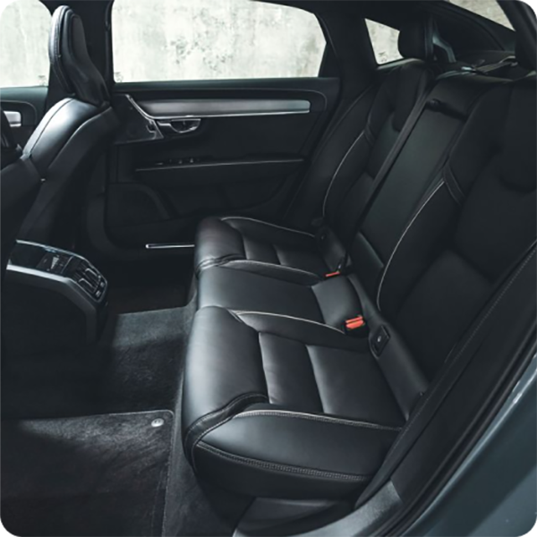
SEDAN
Volvo S90 or Tesla Model S
![]() 3 Passengers
3 Passengers
![]() 2 large & 1 small suitcase
2 large & 1 small suitcase
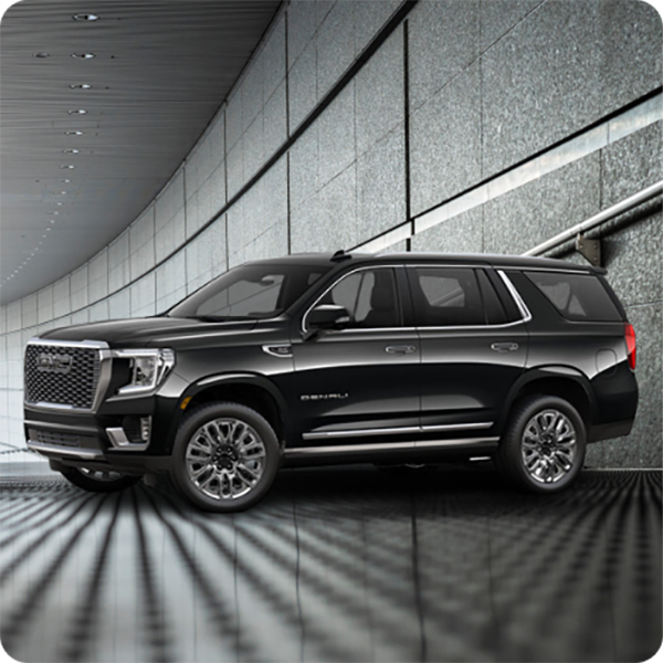
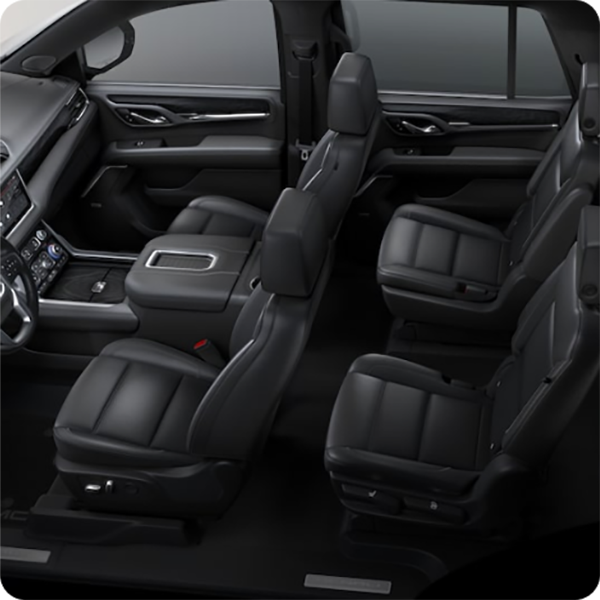
SUV
GMC Yukon Denali, Chevrolet Suburban
![]() 6 Passengers
6 Passengers
![]() Expect to fit 3–4 large suitcases behind the 3rd row. Folding that row down expands space for 8–10
Expect to fit 3–4 large suitcases behind the 3rd row. Folding that row down expands space for 8–10


JET EXECUTIVE SPRINTER
![]() 9 + 1 Co-Pilot
9 + 1 Co-Pilot
![]() 10-14 suit cases
10-14 suit cases
Related Resources
Go deeper on any area with these PSS guides and pages:
- 25 Best Things to Do in Las Vegas – the experiences companion to this guide
- Henderson Nevada Guide · North Las Vegas Guide
- Summerlin Car Service · Henderson Car Service · North Las Vegas Car Service
- Local Transportation · Airport Shuttle · Event Transportation
External resources: LVCVA · Visit Las Vegas · Clark County, NV
Las Vegas Areas Quick-Reference Table
| Area | Type | Distance from mid-Strip | Best for |
|---|---|---|---|
| The Strip | Unincorporated (Paradise) | — | First-time tourists, shows, nightlife |
| Downtown / Fremont | City of Las Vegas | ~4 mi | Budget, history, Arts District |
| Paradise | Unincorporated | 0-3 mi | Conventions, airport access |
| Summerlin | Master-planned (NW) | ~12 mi | Quiet stays, Red Rock, dining |
| Henderson | City (SE) | 12-15 mi | Families, Lake Las Vegas, golf |
| North Las Vegas | City (N) | 5-8 mi (center) | Motor Speedway, air show |
| Enterprise | Unincorporated (SW) | 7-10 mi | Allegiant Stadium, residential |
| Spring Valley | Unincorporated (W) | 6-9 mi | Affordable residential |
| Metro population | — | — | ~2.2 million |
| Valley area | — | — | ~640 sq mi |
| Incorporated cities | — | — | Las Vegas, Henderson, North Las Vegas |
| Strip length | — | — | ~4.2 miles |
| Best central base | — | — | Mid-Strip |
| Quietest base | — | — | Summerlin / Henderson |
| Transit to neighborhoods | — | — | Limited — driving metro |
| Recommended transport | — | — | Private car service (fixed rate) |
| PSS booking | — | — | (702) 248-7706 |
Frequently Asked Questions
Methodology & Sources
This guide combines public information from the LVCVA, Clark County, and the cities of Las Vegas, Henderson, and North Las Vegas with Personal Sedan Services routing data for distances and drive times. Population, area, and visitor figures reflect the most recent available 2025-2026 estimates and are rounded for readability. Distances are approximate driving miles from the center of the Strip and vary with traffic. Last Updated: May 2026. This pillar is reviewed and refreshed annually.
Press & media: Journalists and travel writers are welcome to reference or link to this guide. For data or quotes, contact Personal Sedan Services at (702) 248-7706.
