


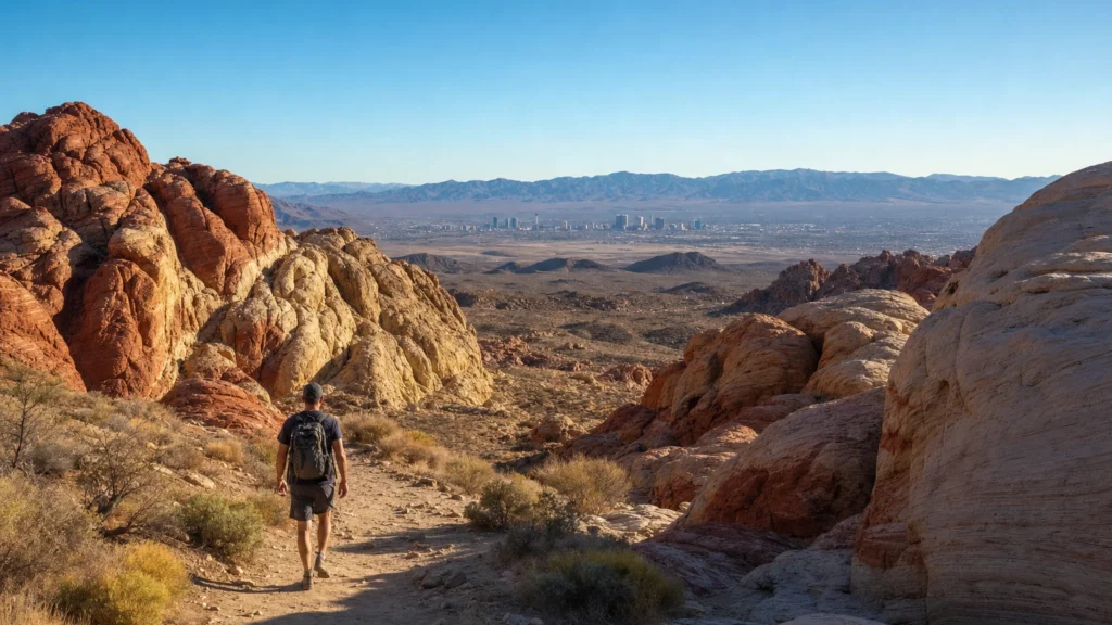
The best hikes near Las Vegas are not on the Strip, they are the four desert playgrounds ringing it: Red Rock Canyon (about 30 minutes west), Valley of Fire (about 50 minutes northeast), Mount Charleston (about 45 minutes north), and Lake Mead (about 40 minutes southeast). Between them you can walk a flat, dog-friendly tunnel trail in the morning and, on another day, climb toward an 11,916-foot summit. Below are 12 trails sorted by skill level, with real distances, difficulty, and exactly how to reach each trailhead.
- Four hiking hubs sit within about an hour of the Strip: Red Rock Canyon, Valley of Fire, Mount Charleston, and Lake Mead National Recreation Area, so a trail for any fitness level is a short ride away.
- There is a genuine easy end and a genuine hard end. The flat Historic Railroad Trail and 1.5-mile Fire Wave suit families, while Charleston Peak at 11,916 feet is a full-day mountaineering effort.
- Season matters more here than almost anywhere. October through April is prime. In summer, hike at dawn only, and expect legal closures: Gold Strike Hot Springs is closed May 15 to September 30.
- Red Rock Canyon needs a timed-entry reservation for its Scenic Drive from October 1 through May 31, so book ahead on Recreation.gov before you go.
- You do not need a rental car. A chauffeured ride from Personal Sedan Services drops your group at the trailhead and is there when you finish, dust and all.
What’s in This Guide
- 1. Historic Railroad Trail (Lake Mead)
- 2. Fire Wave Trail (Valley of Fire)
- 3. Lost Creek and the Children’s Discovery Trail (Red Rock)
- 4. Petroglyph Wall Trail (Red Rock)
- 5. Calico Tanks (Red Rock)
- 6. Ice Box Canyon (Red Rock)
- 7. Mary Jane Falls (Mount Charleston)
- 8. White Domes Loop (Valley of Fire)
- 9. Cathedral Rock (Mount Charleston)
- 10. Turtlehead Peak (Red Rock)
- 11. Gold Strike Hot Springs (Lake Mead)
- 12. Charleston Peak (Mount Charleston)
Plan your trip:
How we grouped these hikes
Every trail here is a real, established route on public land managed by the Bureau of Land Management, the National Park Service, the U.S. Forest Service, or Nevada State Parks. We grouped them into three tiers so you can match a hike to your group in seconds: easy (flat or short, family and beginner friendly), moderate (some climbing, scrambling, or distance, but doable for most active adults), and strenuous (steep, long, exposed, or requiring scrambling and experience).
The four hubs each have a personality. Red Rock Canyon is the closest and most varied, a 195,819-acre conservation area of red-and-buff sandstone just west of town. Valley of Fire is Nevada’s first state park, opened in 1935, famous for fire-red Aztec sandstone. Mount Charleston in the Spring Mountains is the cool escape, often 20 to 30 degrees cooler than the valley floor. Lake Mead National Recreation Area, near Boulder City, mixes flat historic rail beds with rugged hot-spring canyons.
Source: Bureau of Land Management, Red Rock Canyon | Nevada State Parks, Valley of Fire
Plan a Chauffeured Day of Las Vegas Sightseeing
The easy hikes near Las Vegas
Start here if you are hiking with kids, want a gentle warm-up, or would rather enjoy the scenery than earn it the hard way. None of these four asks much beyond good shoes, water, and a hat.
1 Historic Railroad Trail (Lake Mead)
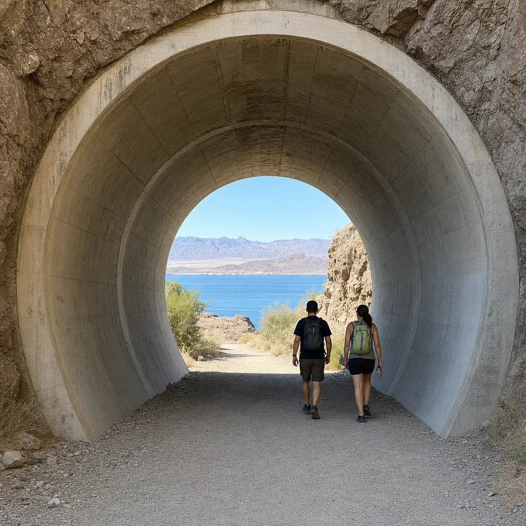
This is the friendliest real hike in the region. The trail follows the bed of the railroad built to haul supplies for the Hoover Dam, running mostly flat past five tunnels, each about 25 feet across, that were blasted through the rock in 1931. The surface was refinished with paw-friendly decomposed granite, so it handles strollers and leashed dogs well, and the reward is a wide-open view over Lake Mead.
Why it matters: it delivers big scenery and genuine history for almost no effort, which makes it the ideal first hike or the recovery-day hike after something harder. How to do it: start from the trailhead off Lakeshore Road near the Alan Bible Visitor Center and turn back whenever you like. It is about 3.7 miles one way to the Hoover Dam parking garage, but the tunnels come well before that, so any out-and-back distance works.
Source: National Park Service, Lake Mead | Travel Nevada trail guide
2 Fire Wave Trail (Valley of Fire)
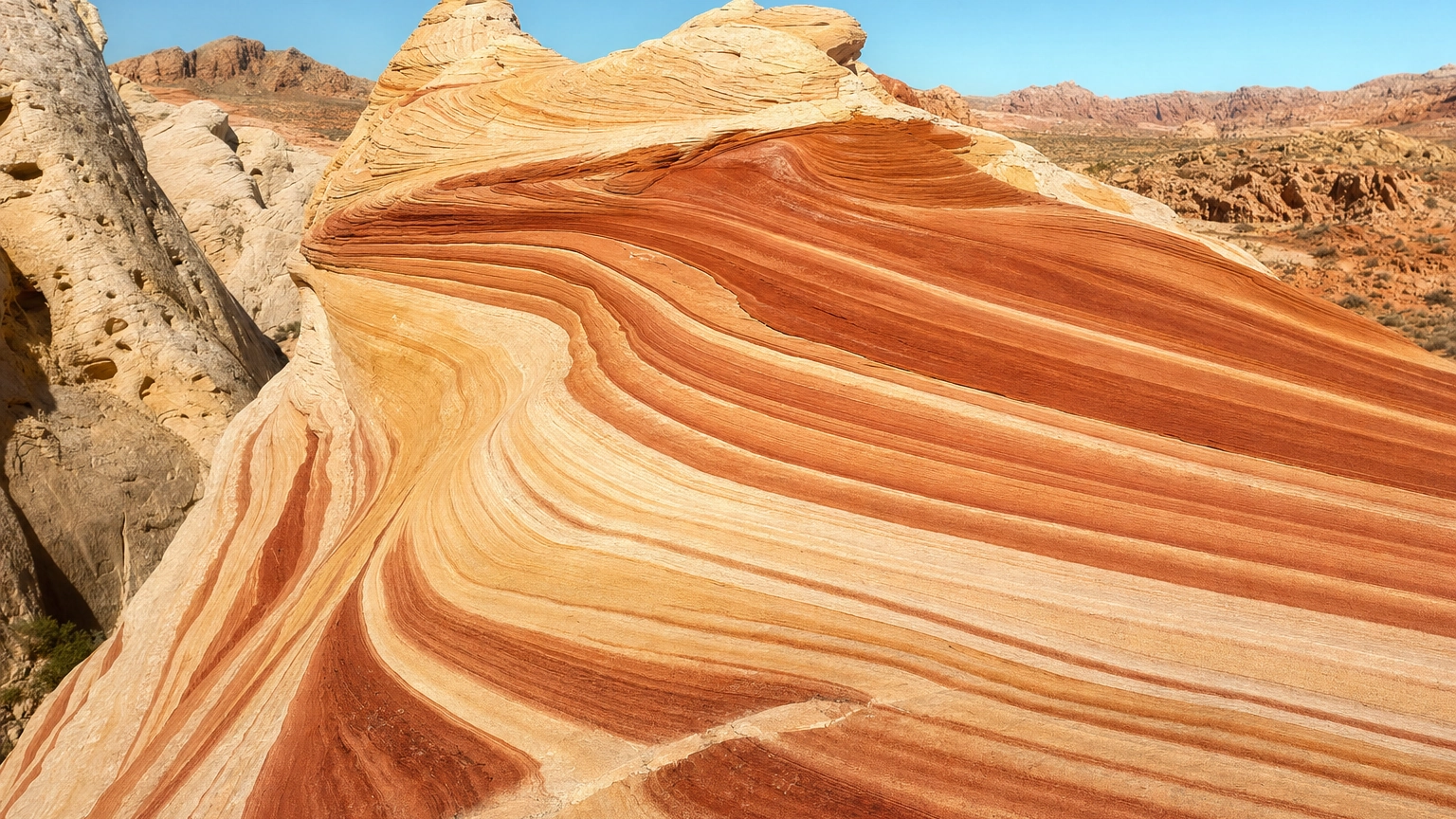
The Fire Wave is the most photographed rock in the region for good reason: bands of red, orange, and cream sandstone ripple across the ground like a frozen wave. The out-and-back is only about 1.5 miles over sand, with no real climbing, so most families finish it comfortably.
Why it matters: it is the single best payoff-to-effort ratio near Las Vegas, a bucket-list photo for a short walk. How to do it: park at lot P3 on White Domes Road inside Valley of Fire State Park and follow the marked posts. Go early. This is open desert, and the Fire Wave and several nearby trails close for heat from May 15 to October 1.
Heads up: the Fire Wave sits on open, shadeless sand. In the warm months it is a dawn-only hike, and the trail is officially closed May 15 through October 1. Do not attempt it midday in summer.
Source: Nevada State Parks, Valley of Fire
3 Lost Creek and the Children’s Discovery Trail (Red Rock)
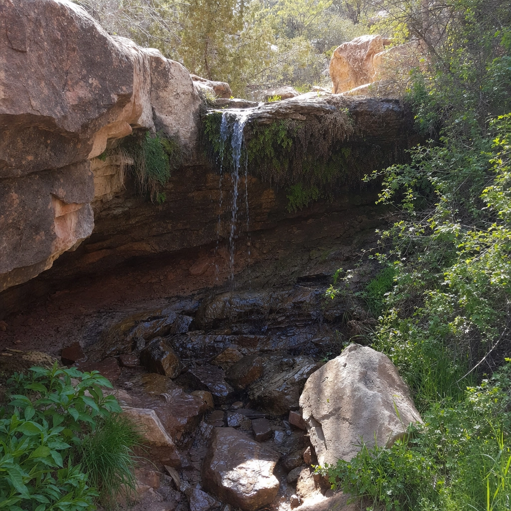
This short loop inside Red Rock Canyon is built for young explorers, with interpretive signs, a boardwalk section, and, in winter and spring, a seasonal waterfall tucked into the canyon wall. The full loop runs under a mile with only gentle ups and downs.
Why it matters: it turns a hike into a treasure hunt for kids, and the waterfall gives even a short walk a real destination. How to do it: park at the Lost Creek and Willow Springs area off the 13-mile Scenic Drive. The waterfall runs after rain and snowmelt, roughly December through April, and slows to nothing in the dry months, so time your visit accordingly.
Source: Red Rock Canyon official trail list
4 Petroglyph Wall Trail (Red Rock)
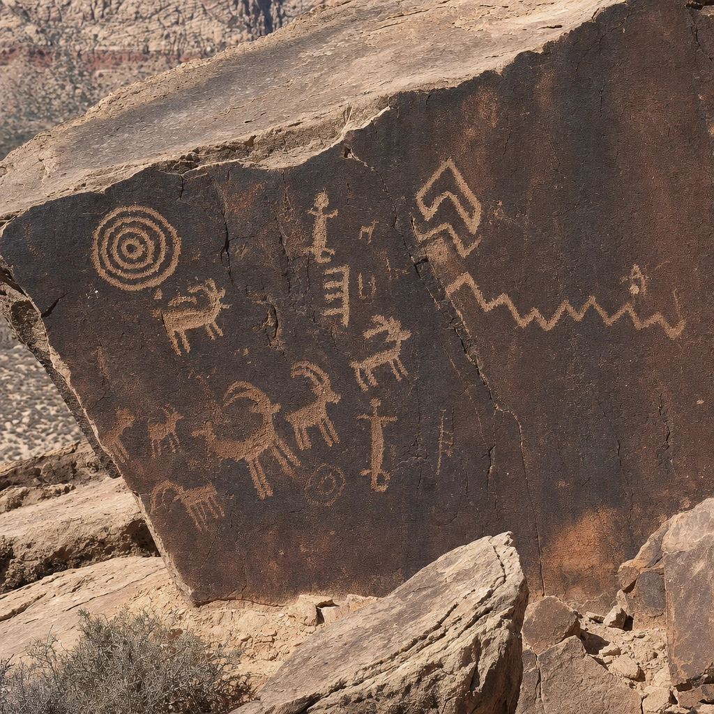
One of the shortest trails on this list is also one of the most meaningful. A brief, nearly flat walk from the Willow Springs picnic area leads to a sandstone panel covered in petroglyphs left by the Indigenous people who lived here long before Las Vegas existed.
Why it matters: it packs deep human history into a five-minute walk, a perfect add-on for any Red Rock visit and a great teaching moment. How to do it: park at Willow Springs on the Scenic Drive and follow the signed path. Look, photograph, and never touch the carvings; skin oils damage them permanently.
Stack your Red Rock hikes. Lost Creek, the Petroglyph Wall, and Calico Tanks all branch off the same 13-mile Scenic Drive, so one timed-entry reservation covers a whole morning of hiking. Knock out an easy one and a moderate one on the same visit.
Source: Bureau of Land Management, Red Rock Canyon
Book Group Transportation for Your Hiking Crew
The moderate hikes near Las Vegas
These four ask for a little more: some scrambling, a real climb, or a few miles of distance. They suit most active adults and reward the effort with waterfalls, slot canyons, and Strip-to-desert views.
5 Calico Tanks (Red Rock)
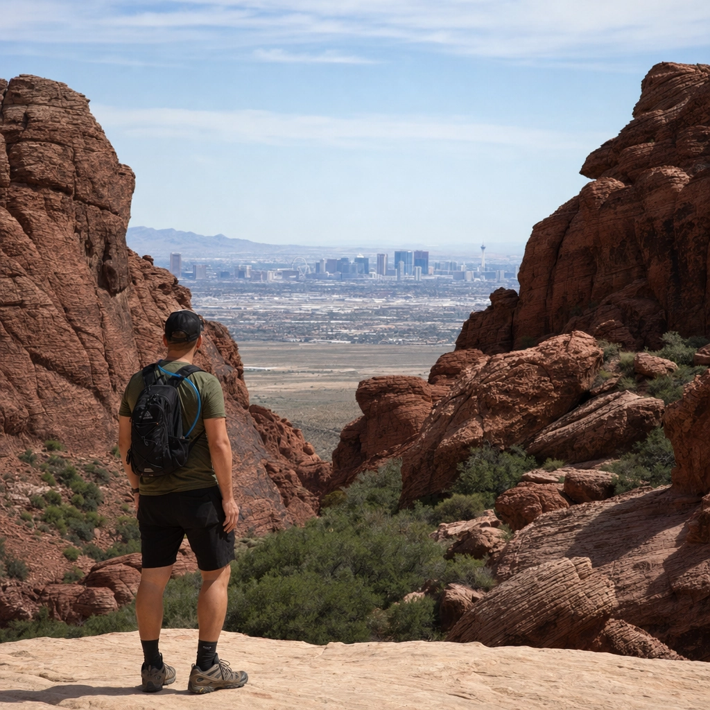
Calico Tanks is the Red Rock hike that earns its reputation. About 2.5 miles round trip with roughly 420 feet of gain, it winds up a canyon of yellow and red sandstone, requires a few easy scrambles over rock, and ends at a natural water tank with a surprise view: the Las Vegas Strip framed in the distance, casinos and all.
Why it matters: it is the best way to see the desert and the city in a single frame, and the scrambling keeps it interesting without being dangerous. How to do it: park at the Sandstone Quarry lot on the Scenic Drive. Wear grippy shoes for the rock steps, and bring water, since there is little shade.
Source: Red Rock Canyon, Calico Tanks
6 Ice Box Canyon (Red Rock)
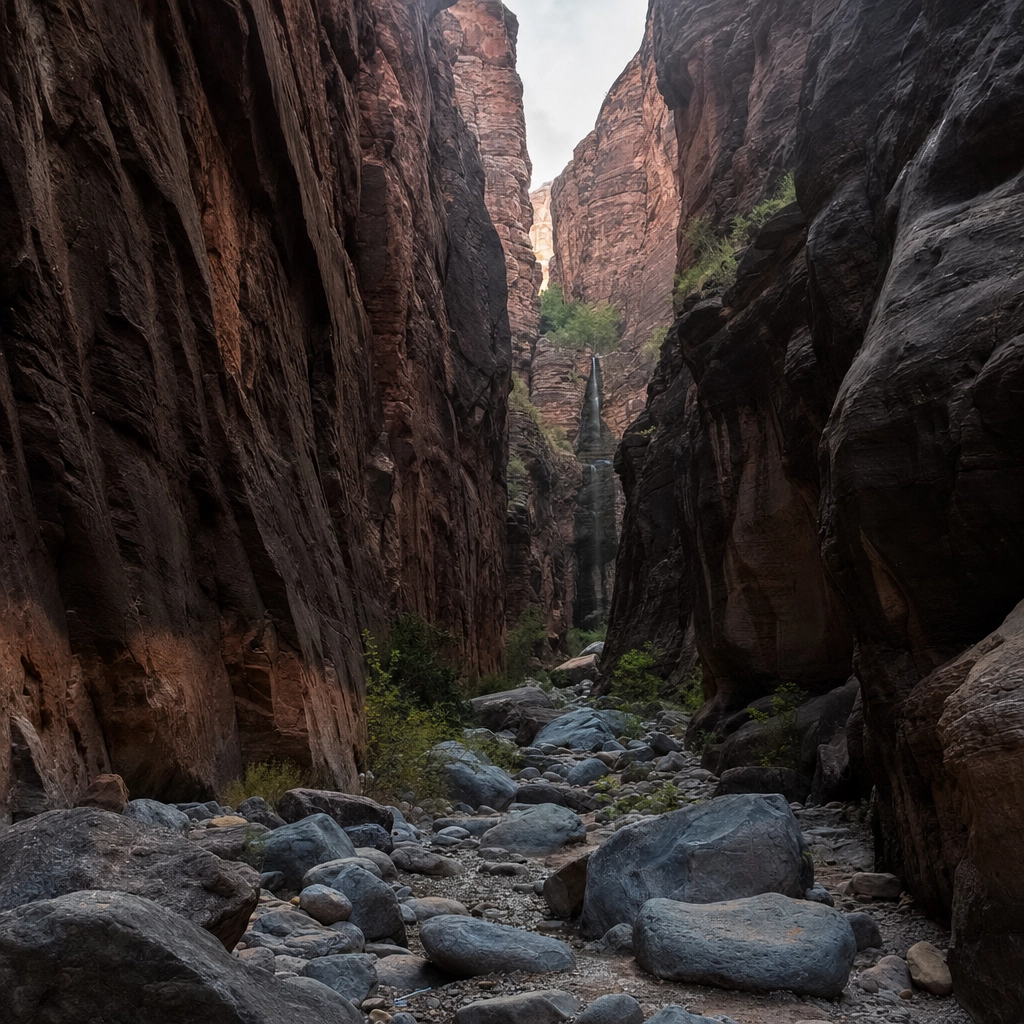
True to its name, Ice Box Canyon stays notably cooler than the open desert, tucked between tall walls that hold shade and channel a breeze. The route runs about 2.2 miles round trip and turns rocky at the end, with boulder-hopping to reach seasonal waterfalls that flow after winter rain and snowmelt.
Why it matters: it is the shady, cooler Red Rock option, and the seasonal falls make a genuine destination. How to do it: park at the Ice Box Canyon lot on the Scenic Drive. Go December through April for water in the falls, and be ready for uneven rock scrambling in the final stretch.
Source: Red Rock Canyon, Ice Box Canyon
7 Mary Jane Falls (Mount Charleston)
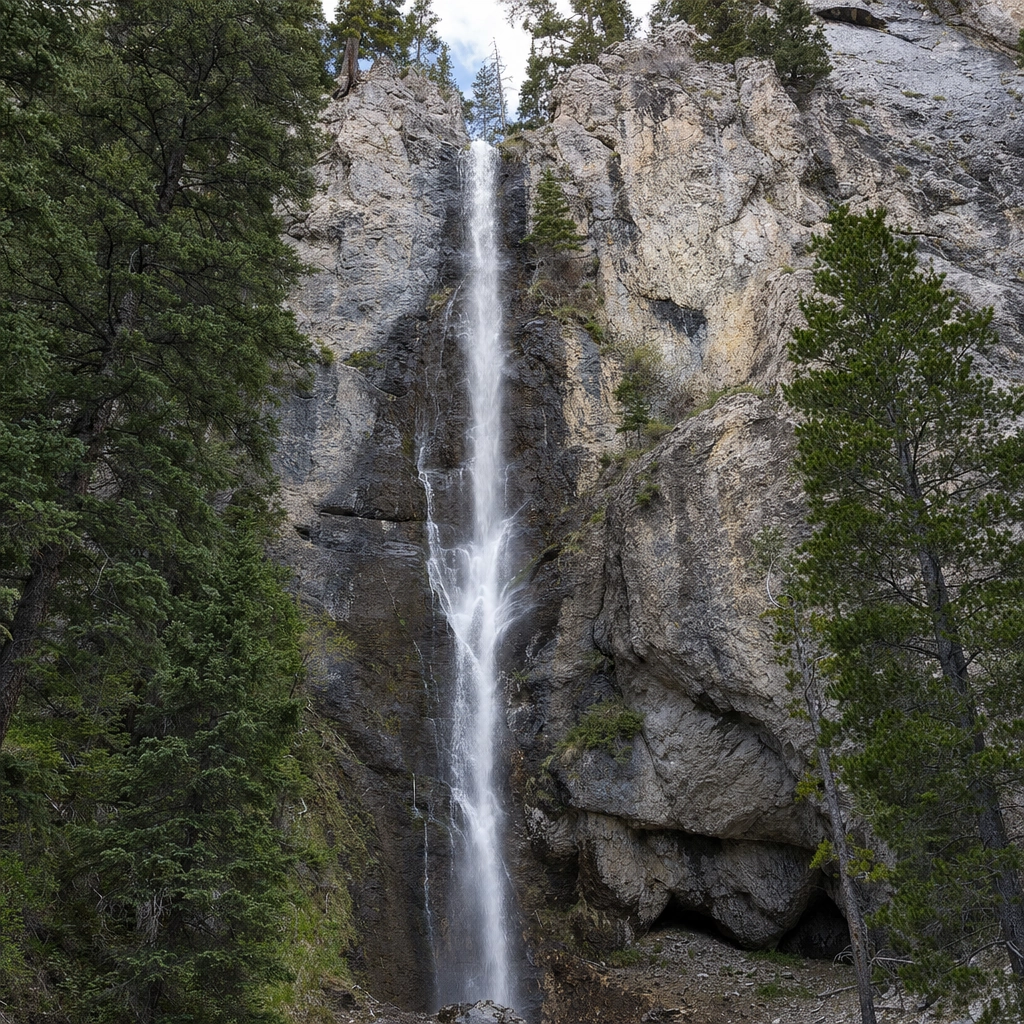
Up in the cool pines of Mount Charleston, Mary Jane Falls climbs about 3.2 miles round trip and roughly 1,000 feet through switchbacks to a rock face where water falls into a shallow alcove and cave. On a hot Vegas day, the mountain air alone is worth the drive.
Why it matters: it is the classic summer escape, often 20 to 30 degrees cooler than the valley, with a waterfall as the payoff. How to do it: drive to the Mary Jane Falls trailhead at the end of Echo Road in Kyle Canyon. The switchbacks are the hard part, so pace yourself, and check conditions in spring when snow can linger on the upper trail.
Source: Go Mt. Charleston, Mary Jane Falls
8 White Domes Loop (Valley of Fire)
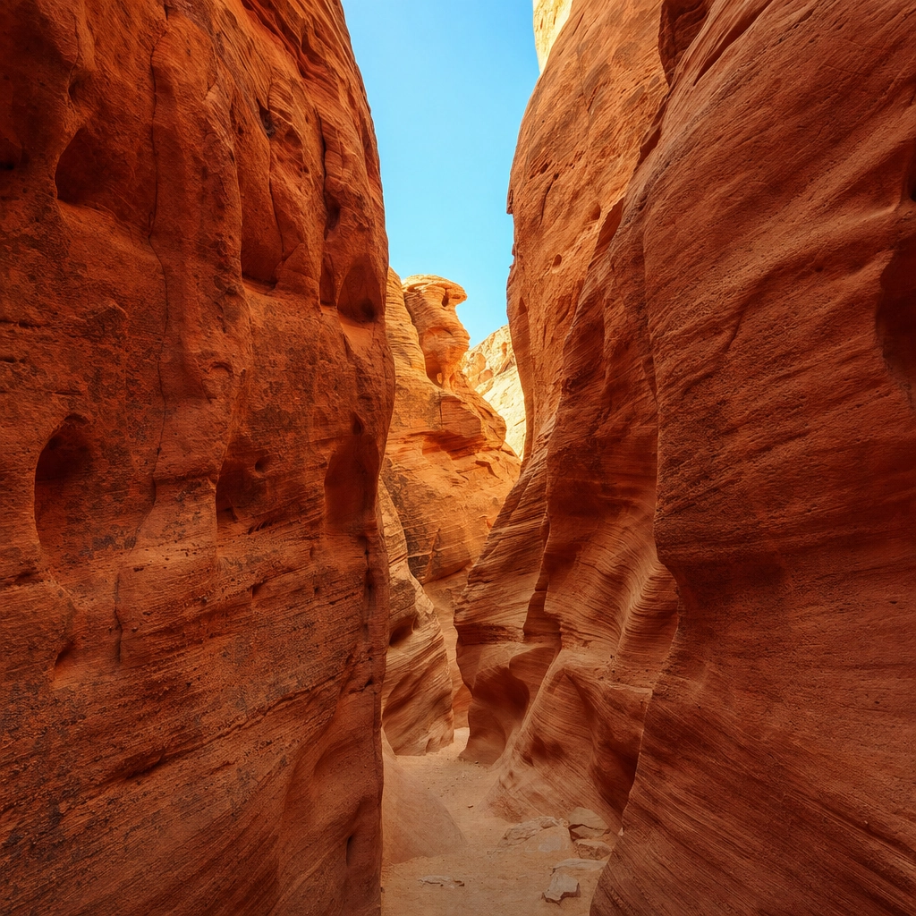
The White Domes Loop is short at about 1.1 miles, but it packs in the most variety of any Valley of Fire trail: multicolored domes, a genuine slot canyon (widely described as the park’s only true one), the stone remains of an old movie set, and rolling sand. There is a bit of downclimbing into the wash, which nudges it into moderate territory.
Why it matters: it is a highlight reel of desert scenery in barely a mile, and the slot canyon is a rare treat this close to Las Vegas. How to do it: park at the end of White Domes Road (lot P3, the same area as the Fire Wave). Like the rest of the park’s exposed trails, save it for the cooler months and early hours.
Two hikes, one trip. The White Domes Loop and the Fire Wave share the same parking area at the north end of Valley of Fire. Pair them for a spectacular half-day, then let your driver handle the hour back to town while you nap.
Source: Nevada State Parks, Valley of Fire
Reserve Local Transportation Across the Valley
Elevation gain, hike by hike
Distance alone does not tell you how hard a hike feels; climbing does. Here is the elevation gain for the moderate and strenuous day hikes on this list, from gentlest to steepest. The long-haul Charleston Peak is in its own class and is not charted here.
Elevation gain by trail (feet, round trip day hikes)
Sources: Bureau of Land Management / Red Rock Canyon, Go Mt. Charleston, National Park Service. Figures are approximate and vary slightly by source.
The strenuous hikes near Las Vegas
These four are for fit, prepared hikers. Expect steep grades, real distance, scrambling, or high altitude, and treat water, timing, and turnaround decisions as safety gear, not suggestions.
9 Cathedral Rock (Mount Charleston)
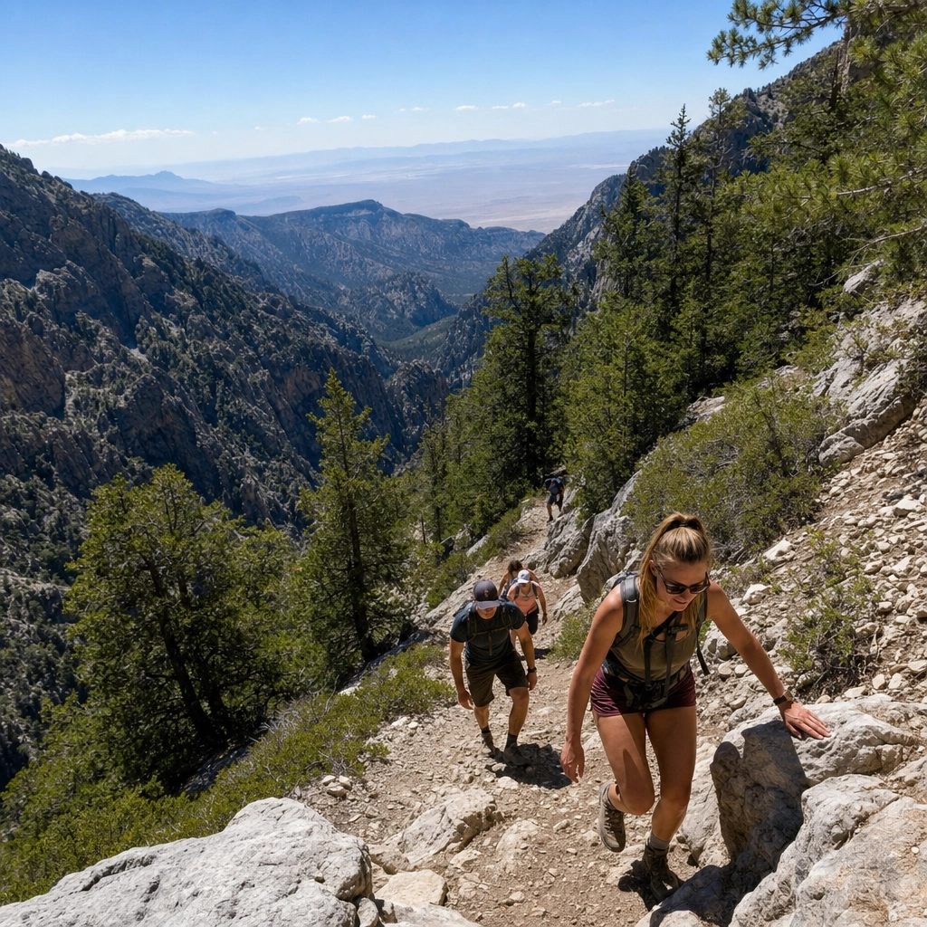
Cathedral Rock is a short but steep Mount Charleston classic, about 2.8 miles round trip with roughly 950 feet of gain packed into a relentless set of switchbacks. The summit outcrop delivers a huge view down Kyle Canyon that feels earned.
Why it matters: it is the best big-view-for-the-effort summit near town, and the pine forest keeps it cool in summer. How to do it: start from the Cathedral Rock trailhead near the Mount Charleston Lodge area. The climbing is constant, so take the switchbacks slow, and watch the exposed final section near the top.
Source: Go Mt. Charleston trail information
10 Turtlehead Peak (Red Rock)
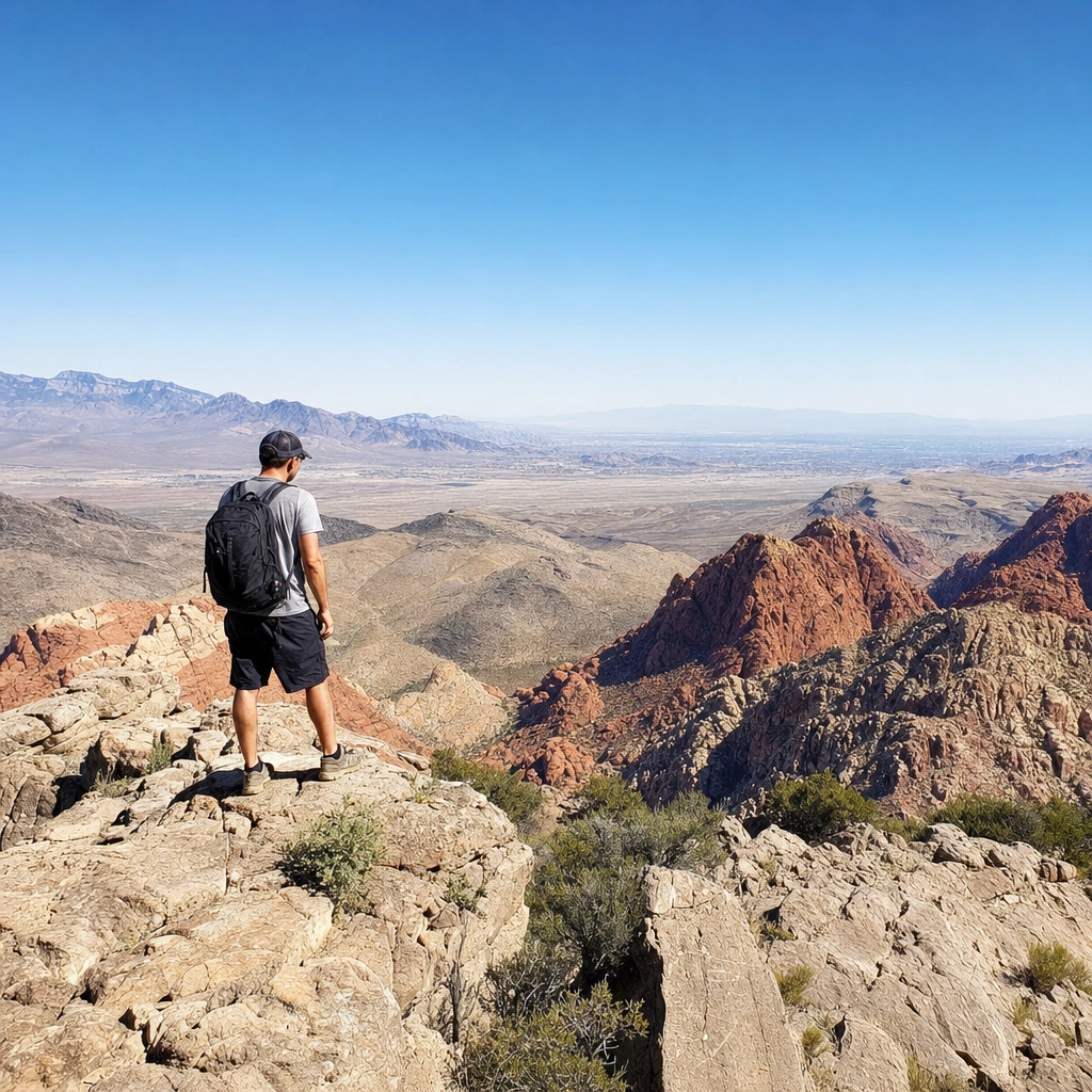
Turtlehead Peak is Red Rock’s hardest signature hike: about 5 miles round trip with roughly 2,000 feet of climbing to a 6,323-foot summit. There is loose rock, real route-finding, and a lot of up, but the reward is a 360-degree view over the entire conservation area and out to the valley.
Why it matters: it is the summit that turns a Red Rock trip into a mountaineering-lite challenge, and the panorama is the best in the park. How to do it: start from the Sandstone Quarry lot. Carry plenty of water, start early to beat the heat, and be honest about the loose descent, which is where most people slip.
Source: Bureau of Land Management, Red Rock Canyon
Getting to a remote trailhead is half the battle. Rideshare apps are unreliable at desert trailheads, and a rented car bakes in the lot all day. A chauffeured drop-off and pickup means no parking reservation, no hot car, and no waiting for a ride that may never come after a long hike.

The two toughest hot-weather cautions
The final two hikes are the most rewarding and the most demanding on this list, and both carry serious heat warnings. Read the safety section below before you attempt either.
11 Gold Strike Hot Springs (Lake Mead)
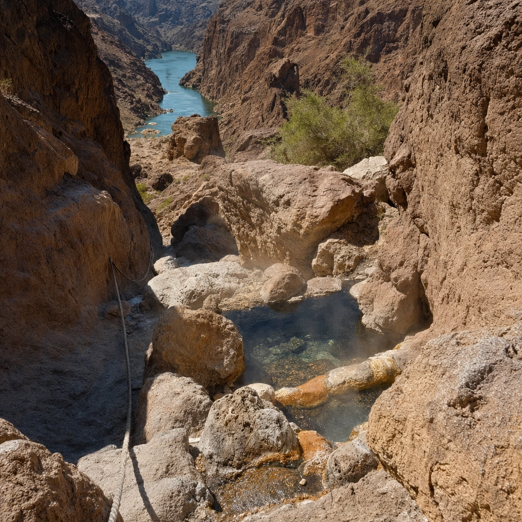
Gold Strike Hot Springs is an adventure hike, about 5.3 miles round trip with roughly 1,200 feet of change, dropping through a boulder-choked canyon (with fixed ropes to help on the scrambles) to natural hot-spring pools and, at the bottom, the Colorado River. It is thrilling and genuinely strenuous.
Why it matters: few hikes near Las Vegas mix scrambling, hot springs, and a river in one trip. How to do it: start from the Gold Strike trailhead off U.S. 93 near Boulder City, and use the ropes for the downclimbs. This canyon is deadly in heat, so note the closure below and never go in summer.
Closed for heat, and for good reason. The Gold Strike Hot Springs route is officially closed May 15 through September 30 each year. Sunstroke and dehydration in this canyon have led to rescues and deaths. Hike it only in the cool season, early in the day, with plenty of water. Source: National Park Service, Lake Mead.
Source: National Park Service, Lake Mead
12 Charleston Peak (Mount Charleston)
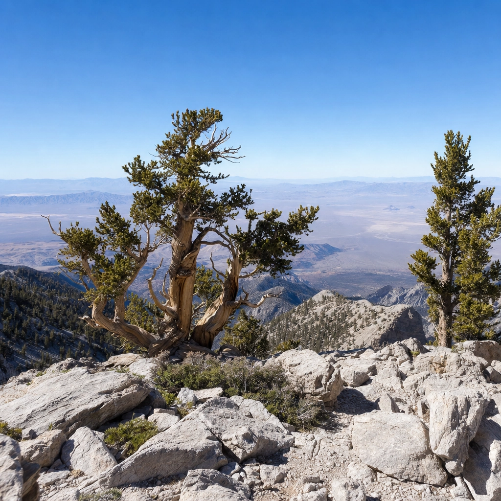
Charleston Peak is the crown of the region. At 11,916 feet it is the highest point in the Spring Mountains and all of Southern Nevada, and the popular South Loop approach runs roughly 17 miles round trip with thousands of feet of gain and thin alpine air near the top. This is a long, committing day for fit, experienced hikers only.
Why it matters: it is the ultimate hiking goal near Las Vegas, a true summit with ancient bristlecone pines and a view across the desert. How to do it: approach via the South Loop, Trail Canyon, or North Loop trailheads. Start before dawn, watch the weather (summer lightning is a real hazard up high), and turn around on schedule. Snow can bury the upper mountain well into spring.
Source: U.S. Forest Service, Spring Mountains National Recreation Area
Desert hiking safety: beat the heat
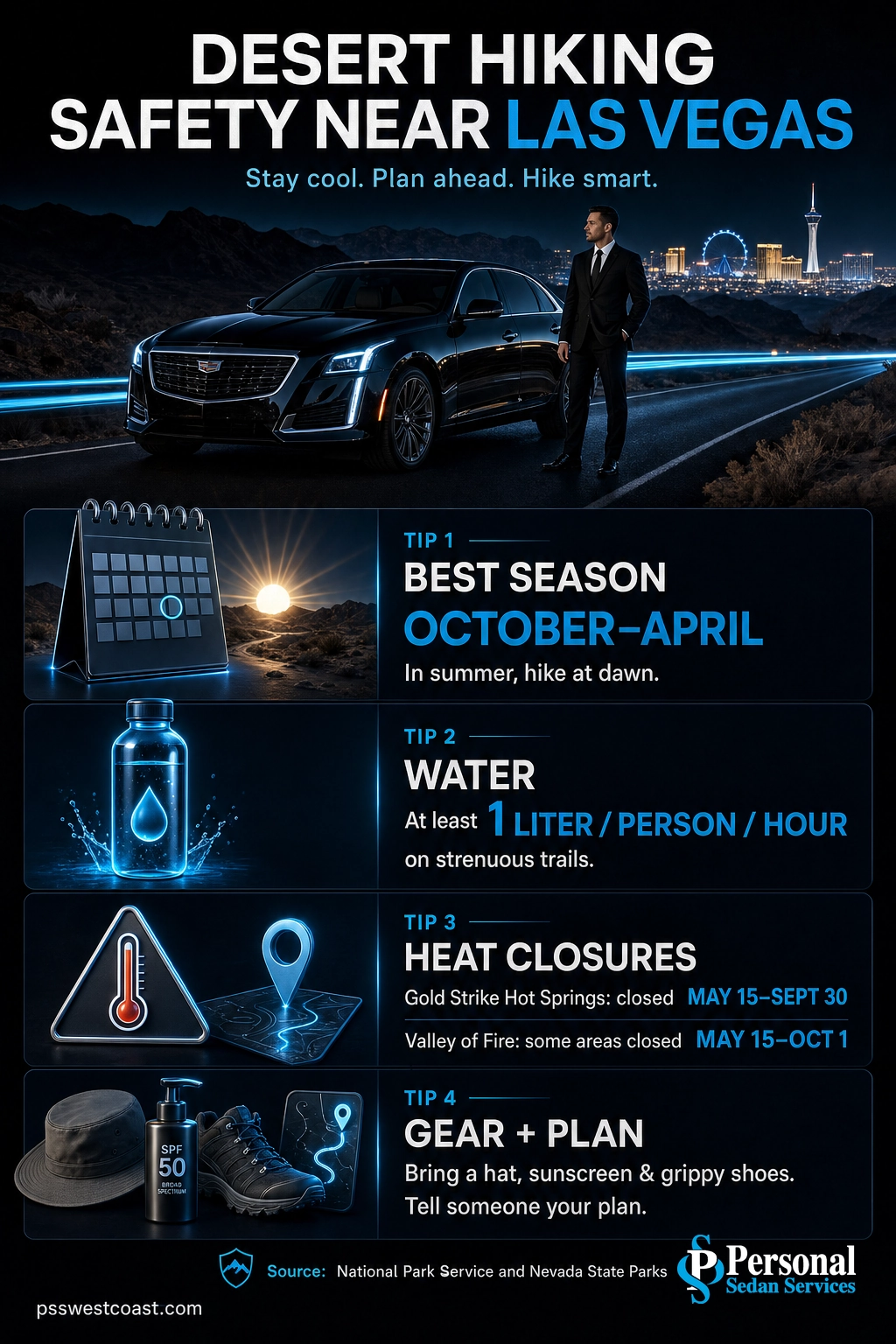
The Mojave Desert is unforgiving, and heat is the biggest danger on every trail here. The rules are simple and they save lives.
Myth: “I’ll be fine, I’ve got a water bottle.” One bottle is not enough for a desert summer hike. Land managers close trails like Gold Strike Hot Springs (May 15 to September 30) and several Valley of Fire routes (May 15 to October 1) precisely because fit, well-meaning hikers still get into life-threatening trouble in the heat. When a trail is closed for heat, that closure is the expert telling you not to go.
- Hike October through April, or at dawn. In the warm months, be finished before the heat builds. Midday summer hiking in exposed desert is genuinely dangerous.
- Carry more water than feels reasonable. Plan for at least a liter per person per hour on a strenuous trail, plus electrolytes.
- Respect closures. They are not suggestions. Gold Strike is closed May 15 to September 30; parts of Valley of Fire close May 15 to October 1.
- Sun and footing. Hat, sunscreen, and grippy shoes. Most desert injuries are slips on loose rock and sunburn, not dramatic falls.
- Tell someone your plan and know that cell service is spotty to nonexistent in the canyons.
Source: National Park Service, Lake Mead | Nevada State Parks, Valley of Fire
How to choose your hike

Not sure where to start? Match the hike to your group and your season with this quick reference.
| Hike | Skill | Round trip | Best for |
|---|---|---|---|
| Historic Railroad Trail | Easy | Flexible, flat | Families, dogs, first-timers |
| Fire Wave | Easy | ~1.5 mi | Photographers, quick win |
| Lost Creek / Discovery | Easy | Under 1 mi | Kids, winter waterfall |
| Petroglyph Wall | Easy | Very short | History, add-on walk |
| Calico Tanks | Moderate | ~2.5 mi | Strip views, light scramble |
| Ice Box Canyon | Moderate | ~2.2 mi | Shade, seasonal falls |
| Mary Jane Falls | Moderate | ~3.2 mi | Summer, cool mountain air |
| White Domes Loop | Moderate | ~1.1 mi | Slot canyon, variety |
| Cathedral Rock | Strenuous | ~2.8 mi | Big view, steep climb |
| Turtlehead Peak | Strenuous | ~5 mi | Summit, panorama |
| Gold Strike Hot Springs | Strenuous | ~5.3 mi | Scrambling, hot springs (cool season only) |
| Charleston Peak | Strenuous | ~17 mi | Experienced hikers, the ultimate goal |
If you only do three hikes near Las Vegas: make them the Historic Railroad Trail (easy, dog-friendly, big scenery), Calico Tanks (moderate, with that Strip-from-the-desert view), and Fire Wave (easy, the region’s most iconic photo). Together they show off the desert, the city, and the color in about half a day of walking.
The 12 hikes at a glance
| # | Hike | Why it matters | Difficulty |
|---|---|---|---|
| 1 | Historic Railroad Trail | Flat, historic tunnels, dog-friendly lake views | Easy |
| 2 | Fire Wave | The region’s most iconic striped-sandstone photo | Easy |
| 3 | Lost Creek / Discovery | Kid-friendly loop with a seasonal waterfall | Easy |
| 4 | Petroglyph Wall | Ancient rock art on a five-minute walk | Easy |
| 5 | Calico Tanks | Desert canyon ending at a Strip overlook | Moderate |
| 6 | Ice Box Canyon | Cool, shaded canyon with seasonal falls | Moderate |
| 7 | Mary Jane Falls | Cool mountain waterfall, summer escape | Moderate |
| 8 | White Domes Loop | A rare true slot canyon plus a movie set | Moderate |
| 9 | Cathedral Rock | Steep switchbacks to a huge canyon view | Strenuous |
| 10 | Turtlehead Peak | Red Rock’s hardest summit and best panorama | Strenuous |
| 11 | Gold Strike Hot Springs | Scrambling to hot springs and the Colorado River | Strenuous |
| 12 | Charleston Peak | The 11,916-foot roof of Southern Nevada | Strenuous |
Getting to the trailhead
Every hike on this list is a short drive from the Strip, but the drive is the part people underestimate. Trailheads at Red Rock, Valley of Fire, Mount Charleston, and Lake Mead are spread across the valley and beyond, rideshare pickups out there are unreliable, and a rental car means paying for parking, navigating timed-entry gates, and returning to a sun-baked vehicle after a hard hike.
Personal Sedan Services is Las Vegas’s top-rated luxury transportation, with a perfect 5.0 Google rating from more than 900 reviews. A chauffeured sedan, SUV, or Sprinter can carry your group and gear straight to the trailhead, wait or return on your schedule, and get you back to your hotel comfortable and cool. For visitors flying in, we can pick you up with our airport shuttle from Harry Reid and build the whole day around your hike. Red Rock and Valley of Fire pair naturally with our Summerlin car service on the west side, while the Lake Mead and Gold Strike trailheads are an easy run through our Boulder City transportation area. For a full itinerary of trails, dining, and sightseeing, our Las Vegas car service team can plan the logistics end to end, and there is always more things to do in Las Vegas to fold into the day.
Map tip: plot your trailhead before you go. Red Rock Canyon is about 20 miles west of the Strip on West Charleston Boulevard (State Route 159); Valley of Fire is about 50 miles northeast via Interstate 15; Mount Charleston is about 35 miles northwest via U.S. 95 and State Route 157; and the Lake Mead and Gold Strike trailheads sit near Boulder City off U.S. 93. Your chauffeur handles the navigation and the timed-entry gate so you can save your energy for the trail.
Book Your Ride to the Trailhead
Frequently asked questions
What is the best hike near Las Vegas for beginners?
How far is Red Rock Canyon from the Las Vegas Strip?
When is the best time to hike near Las Vegas?
Do you need a reservation to hike Red Rock Canyon?
What is the hardest hike near Las Vegas?
Sources
Sources and methodology
This guide draws trail distances, difficulty, elevation, and closure information from the public land managers and official park resources for each area. Drive times and distances from the Strip are approximate. Figures marked as approximate vary slightly between official sources; we cite the managing agency wherever possible.
- Bureau of Land Management, Red Rock Canyon National Conservation Area
- Red Rock Canyon, official hikes and trails
- Nevada State Parks, Valley of Fire State Park
- Go Mt. Charleston, hikes and trails
- National Park Service, Lake Mead, Historic Railroad Trail
- National Park Service, Lake Mead, Gold Strike closure
- Recreation.gov, Red Rock Canyon Scenic Drive timed entry