


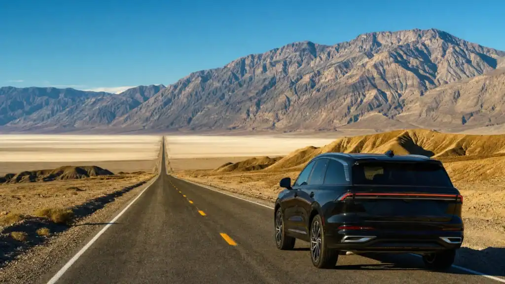
Quick answer: Death Valley is the closest national park to Las Vegas. Furnace Creek, at the center of the park, is about 120 miles and a 2 hour drive on the shortest route through Pahrump. Three other paved routes run 145 to 172 miles and take 2.5 to 3.5 hours. The best time to visit is mid October through April, when the desert is mild instead of dangerous.
Most people who search “how far is Death Valley from Las Vegas” want two answers at once: how long is the drive, and can I do it in a day? The good news is that Death Valley is closer than the Grand Canyon or Zion, close enough for an easy day trip, and the drive is paved the entire way. The one thing that changes everything is when you go. In January the valley is a spectacular 70-degree afternoon. In July it is the hottest place on the planet.
- Distance: about 120 miles and 2 hours from Las Vegas to Furnace Creek on the shortest route, through Pahrump and Death Valley Junction.
- Closest national park: Death Valley is the nearest national park to Las Vegas, closer than the Grand Canyon, Zion, or Sedona.
- Four paved routes: the shortest (120 mi), the easiest (145 mi via US-95), the ghost-town route (160 mi past Rhyolite), and the scenic route (172 mi in past Badwater).
- Best time to visit: mid October through April. Winter and spring are mild; summer highs average the mid 110s and regularly pass 120 degrees.
- Superlatives: Badwater Basin is the lowest point in North America at 282 feet below sea level, and Furnace Creek holds the world heat record of 134 degrees.
- An easy day trip to drive yourself, but a private chauffeured car lets your whole group arrive rested on the long desert highways.
What’s in This Guide
- How Far Is Death Valley from Las Vegas?
- The Four Routes from Las Vegas to Death Valley
- The Best Route (And What You See Along the Way)
- The Best Time to Visit Death Valley
- What Makes the Drive Worth It
- Planning a Death Valley Day Trip from Las Vegas
- Drive Yourself, Take a Tour, or Hire a Private Car?
- Frequently Asked Questions
- Related Las Vegas Travel Guides
How Far Is Death Valley from Las Vegas?
From Las Vegas to Furnace Creek, the developed heart of Death Valley National Park, the shortest paved route is about 120 miles and takes roughly two hours. That makes Death Valley the closest national park to Las Vegas, nearer than the Grand Canyon, Zion, or Sedona, and comfortably within reach of a single day.
The reason the distance question has more than one answer is that Death Valley is enormous. At more than 3.4 million acres it is the largest national park in the contiguous United States, so where you enter and what you want to see both move the number. Most first-time visitors aim for Furnace Creek, since it holds the visitor center and sits close to the headline sights. Measured to that point, here is how the mileage and drive time compare across the four paved approaches.
| Route | Distance to Furnace Creek | Drive time (one way) | Main roads | Best for |
|---|---|---|---|---|
| Shortest | ~120 miles | ~2 hours | NV-160 to Pahrump, Bell Vista Rd, CA-190 | Fastest way in, day trips |
| Easiest | ~145 miles | ~2.5 hours | US-95 to Lathrop Wells, CA-127, CA-190 | Simple driving, fewer turns |
| Ghost Town | ~160 miles | ~3 hours | US-95 to Beatty, NV-374, Beatty Cutoff | Rhyolite ghost town on the way |
| Most Scenic | ~172 miles | ~3.5 hours | NV-160, Tecopa Rd, CA-127, Badwater Rd | Entering past Badwater Basin |

Distances and times are approximate and reflect the National Park Service route guide and Google Maps from Las Vegas. Actual times shift with traffic leaving the valley, the season, and how many photo stops you make once the scenery opens up.
Source: Death Valley directions (NPS)
The Four Routes from Las Vegas to Death Valley
The National Park Service publishes four paved approaches from Las Vegas, each with a different trade-off between speed and scenery. All four are suitable for a normal car.
The shortest route (about 120 miles, 2 hours)
From Interstate 15 south, exit onto NV Highway 160 west and drive about 60 miles to Pahrump, Nevada. Turn left on Bell Vista Road, about three miles north of Highway 372, and follow it 30 miles to Death Valley Junction, California. Turn right on CA Highway 127, then almost immediately left on CA Highway 190, and drive the final 30 miles to the Furnace Creek Visitor Center. This is the fastest way in and the route most day-trippers take.
The easiest route (about 145 miles, 2.5 hours)
If you prefer wide highway and fewer turns, exit onto US Highway 95 north and drive about 90 miles to Lathrop Wells. Turn left on NV Highway 373, which becomes CA Highway 127, and continue 25 miles to Death Valley Junction. Turn right on CA Highway 190 for the last 30 miles to Furnace Creek. It is longer than the shortest route but the simplest to navigate.
The ghost-town route (about 160 miles, 3 hours)
Take US Highway 95 north about 120 miles to Beatty, Nevada, then turn left on NV Highway 374. This approach passes the Rhyolite ghost town, a photogenic set of early-1900s mining ruins just outside Beatty, and drops you near the Mesquite Flat Sand Dunes. From Highway 374 it is 19 miles to Hells Gate, a turn onto Beatty Cutoff Road, and then CA Highway 190 to Furnace Creek.
The most scenic route (about 172 miles, 3.5 hours)
The longest option enters the park low. Follow NV Highway 160 west, turn onto Tecopa Road (the Old Spanish Trail), pick up CA Highway 127, then CA Highway 178 west, better known as Badwater Road. You reach Badwater Basin, the lowest point in North America, before you ever get to Furnace Creek. It adds about 90 minutes over the shortest route but front-loads the drama.
Fuel and navigation tip: Once you leave the Las Vegas valley, gas stations and cell coverage thin out fast, and the park has almost no signal on its interior roads. The Park Service warns travelers not to rely only on vehicle GPS, since some systems route people onto closed or dead-end roads. Top off your tank in Pahrump or Beatty, carry water, and download your route and the NPS app for offline use before you go.
Source: Death Valley directions and safety (NPS)
The Best Route (And What You See Along the Way)
For a first visit or a day trip, the shortest route through Pahrump and Death Valley Junction is the best choice. It is fully paved, it is the quickest way to the visitor center and the main sights, and it drops you at Furnace Creek with the most time left to explore. From there, Badwater Basin, Zabriskie Point, and the Mesquite Flat Sand Dunes are all short drives.
If you have extra hours and want the drive itself to be part of the trip, the ghost-town route past Rhyolite or the scenic route in past Badwater both reward the detour. Rhyolite, just outside Beatty, is one of the most accessible ghost towns in the region and makes a natural first stop. Whichever way you go, the payoff is the same: the road opens onto a landscape of salt flats, folded badlands, and mountains that few visitors expect to be this close to the Strip.

Source: Death Valley directions (NPS)
The Best Time to Visit Death Valley
Timing matters more in Death Valley than in almost any other park. The best window runs from mid October through April, when winter and spring bring mild, comfortable days. January averages a high near 67 degrees and a low around 40, ideal for hiking the dunes and walking the Badwater salt flats. Spring adds the chance of wildflowers, which bloom across the low elevations in a good year from roughly February into April.
Death Valley Average High Temperature by Season (Furnace Creek)
Approximate average daily high temperatures at Furnace Creek. Source: National Park Service.
Do not underestimate the summer heat: From June through August, average highs at Furnace Creek sit in the mid 110s and regularly climb past 120 degrees in the shade. This is genuinely dangerous, not just uncomfortable. The Park Service urges summer visitors to stay on paved roads, never hike in the low elevations after 10 a.m., and carry far more water than seems necessary. If your only option is a summer trip, treat air conditioning, fuel, and water as non-negotiable, and consider a chauffeured car so no one is stranded with a breakdown in extreme heat.
Source: Death Valley weather and climate (NPS)
What Makes the Drive Worth It
Death Valley is a park of extremes, and the two-hour drive delivers you into a landscape that has no equal in the Southwest. It holds the record for the hottest air temperature ever measured on Earth, and within the same park you can stand at the lowest point on the continent and look up at an 11,000-foot peak.
Beyond those two superlatives, the sights cluster conveniently near Furnace Creek. Badwater Basin is the surreal white salt-polygon flat. Zabriskie Point overlooks rippled golden badlands and is the classic sunrise spot. Mesquite Flat Sand Dunes near Stovepipe Wells are easy to reach and walk. Artists Palette is a short scenic loop of mineral-streaked hills, and Dante’s View looks down more than a mile onto the valley floor. Most day-trippers can pair three or four of these in a single visit.
Source: Death Valley National Park (NPS)
See our Las Vegas attractions transportation
Planning a Death Valley Day Trip from Las Vegas
Because it is only about two hours away, Death Valley is one of the most doable day trips from Las Vegas. A few practical notes keep the day smooth.
- Start early. Leave Las Vegas by 7 or 8 a.m. so you have real time in the park and a relaxed drive home before dark.
- Pay the entrance fee. Death Valley charges a 30-dollar-per-vehicle pass good for seven days, payable at automated kiosks at Furnace Creek, Stovepipe Wells, and the Badwater Road entrance, or in advance on Recreation.gov. The park itself is open 24 hours a day, year-round.
- Fuel up outside the park. Gas is limited and expensive inside Death Valley. Fill the tank in Pahrump or Beatty on the way in.
- Carry water and snacks. Bring more water than you think you need in every season, and food, since dining options are few and far between.
- Check current conditions. Flooding has repeatedly damaged park roads in recent years, and some routes and facilities can be closed for repairs. Confirm road status on the NPS site before you leave.
Day trip or overnight? A day trip covers the headline sights around Furnace Creek comfortably. If you want to add sunrise at Zabriskie Point, sunset at Dante’s View, or the far corners of this huge park, an overnight in Furnace Creek or Stovepipe Wells turns a rushed loop into a relaxed two days.

Source: Death Valley fees and passes (NPS)
Drive Yourself, Take a Tour, or Hire a Private Car?
There are three honest ways to get from Las Vegas to Death Valley, and the right one depends on your group, your budget, and how much of the day you want to spend driving remote desert highways.
Drive yourself
The cheapest and most flexible option. You control the stops and the pace. The downsides are four or more hours of round-trip driving on unfamiliar roads with little fuel or cell service, and, in the warm months, real risk if the car has trouble in extreme heat.
Join a group bus tour
Convenient and often packaged with a guide and lunch. The trade-off is a fixed schedule, shared time with strangers, and limited flexibility if you want to linger at Badwater or catch the light at Zabriskie Point. It suits solo travelers who would rather not drive at all.
Hire a private chauffeured car
The middle path many visitors overlook. A private chauffeur handles every mile in a luxury sedan, SUV, or van, so your group travels together, stops where you want, and arrives rested instead of road-weary. For families, couples, and small groups who want the freedom of a self-drive without the fatigue or the heat risk, it is the most comfortable way to see the park. Larger parties can spread out in a group vehicle built for the distance, and a professional driver who knows the desert routes takes the guesswork out of the day.
Frequently Asked Questions
How far is Death Valley from Las Vegas?
Can you visit Death Valley as a day trip from Las Vegas?
What is the best time to visit Death Valley?
What is the best route from Las Vegas to Death Valley?
How hot does Death Valley get?
Related Las Vegas Travel Guides
- Grand Canyon distance and drive time – three rims compared, from the closest to the classic.
- Zion National Park drive and route – red canyons on a slightly longer drive.
- Hoover Dam distance and getting there – a shorter half-day trip east of the city.
- Sedona, Arizona distance and tips – red rock country beyond the desert.
- Laughlin, Nevada drive and what to do – a river town day trip south of the valley.
- Best day trips from Las Vegas – the full menu of drives worth taking.
Explore our luxury transportation options
Sources and Methodology
Route mileages, drive times, safety guidance, entrance fees, and seasonal temperatures come from the U.S. National Park Service, including the official Routes from Las Vegas guide and the park weather and fees pages. The world heat record of 134 degrees Fahrenheit on July 10, 1913, and the Badwater Basin elevation of 282 feet below sea level are National Park Service figures. Driving distances and times are approximate and reflect the NPS route guide and Google Maps from Las Vegas; actual times vary with traffic, weather, road closures, and stops.