


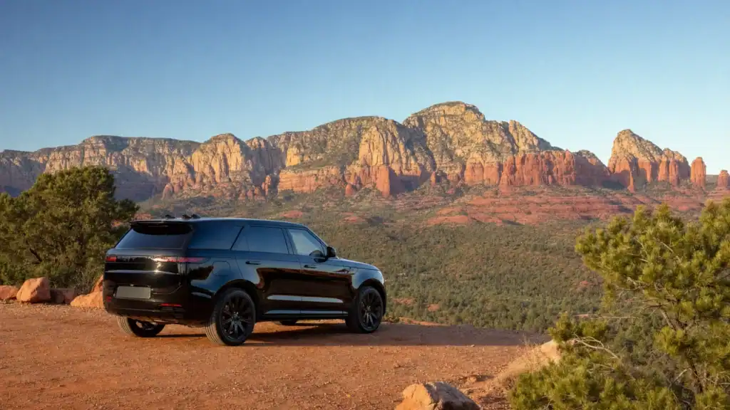
Quick answer: Sedona, Arizona sits about 278 miles from Las Vegas, which is roughly a 4.5 hour drive one way. The straight-line distance is only about 213 miles, but no direct highway connects the two, so the real drive runs southeast through Kingman and Flagstaff before dropping into red rock country. There is no train or nonstop flight, so nearly everyone makes this trip by road.
If you are searching “how far is Sedona from Las Vegas,” you are usually weighing two things at once: the miles, and whether the drive is worth it. Here is the honest version. Sedona is about 278 miles away, a scenic but real four-and-a-half-hour haul that crosses two states and climbs from the desert floor to 4,500 feet of red rock. It is one of the most beautiful drives in the Southwest, and also one of the longer day trips from Las Vegas, so knowing the route and the stops before you go is what turns a long drive into a great one.
- Distance: about 278 miles by road from Las Vegas to Sedona (roughly 213 miles in a straight line).
- Drive time: about 4.5 hours one way with no stops, or close to 9 hours round trip.
- Best route: US-93 south to Kingman, Interstate 40 east to Flagstaff, then State Route 89A or Interstate 17 south into Sedona.
- Scenic finish: the drop into Sedona on Highway 89A runs through Oak Creek Canyon, a 15-mile National Scenic Byway.
- Elevation: Sedona sits at about 4,500 feet, so it is cooler than Las Vegas and can see snow and icy canyon roads in winter.
- A same-day round trip is doable but long. Many visitors choose an overnight or a private chauffeured car so the drive is not rushed.
What’s in This Guide
- How Far Is Sedona from Las Vegas? Distance and Drive Time
- The Best Route from Las Vegas to Sedona
- Scenic Oak Creek Canyon vs. the Faster I-17 Route
- Is Sedona a Day Trip from Las Vegas?
- Best Stops on the Drive from Las Vegas to Sedona
- What to Do Once You Reach Sedona
- Drive Yourself, Fly, or Hire a Private Car?
- Planning Your Sedona Trip from Las Vegas
- Frequently Asked Questions
- Related Las Vegas Travel Guides
How Far Is Sedona from Las Vegas? Distance and Drive Time
Sedona is about 278 miles from Las Vegas by road, a figure the official Sedona tourism board and mapping tools agree on within a mile or two. That works out to roughly four and a half hours of driving if you go straight through. The reason the drive feels longer than the map’s straight line is geography: the two cities are only about 213 miles apart as the crow flies, but the Colorado River, the Grand Canyon, and a wall of high country sit between them, so every practical route swings southeast and adds real distance.
| Measure | Las Vegas to Sedona | What it means |
|---|---|---|
| Driving distance | ~278 miles | The real road distance you will actually cover. |
| Straight-line distance | ~213 miles | As the crow flies. There is no direct highway. |
| Drive time (one way) | ~4.5 hours | No stops. Budget 5+ with fuel, food, and photos. |
| Sedona elevation | ~4,500 ft | Cooler than the valley, with winter snow possible. |

There is no passenger train between the two cities and no regular nonstop commercial flight into Sedona itself, so for almost every traveler this is a driving trip. That makes the route and the timing the two things worth getting right before you leave.
Source: Visit Sedona official travel information
The Best Route from Las Vegas to Sedona
The main route is straightforward for most of the way and only gets interesting at the end. From Las Vegas you head southeast out of the valley, cross into Arizona, and follow the high desert toward Flagstaff before turning down into Sedona.
The standard drive works like this:
- US-93 south to Kingman, Arizona. Leave Las Vegas heading southeast, pass the Hoover Dam area, and follow US-93 across the desert to Kingman, an old Route 66 town and the first real fuel-and-food stop.
- Interstate 40 east to Flagstaff. Join I-40 at Kingman and climb steadily east through Seligman and Williams. This is the longest stretch, a smooth interstate that gains elevation the whole way to Flagstaff at about 7,000 feet.
- South into Sedona. At Flagstaff you choose your finish: the scenic State Route 89A down through Oak Creek Canyon, or the faster Interstate 17 to Highway 179. Both drop you into Sedona in about the same time.
Fuel and service tip: Once you leave the Las Vegas valley, gas stations get sparse until Kingman, and again between the Route 66 towns. Top off the tank before you go, carry water, and download your route for offline use, because cell coverage drops out across long desert stretches.

Source: Sedona driving directions and travel routes
See our Las Vegas attractions transportation
Scenic Oak Creek Canyon vs. the Faster I-17 Route
The one real decision on this drive comes at Flagstaff, and it is the detail most first-timers do not plan for. You can reach Sedona two ways, and they take about the same amount of time, but they are very different experiences.
| Final leg | Highways from Flagstaff | Character | Best for |
|---|---|---|---|
| Scenic finish | State Route 89A through Oak Creek Canyon | Forested canyon, hairpin switchbacks, red rock overlooks | Views, photos, mild-weather days |
| Faster finish | Interstate 17 south to Highway 179 | Open freeway, gentle grades, the Red Rock Scenic Byway into town | Winter, RVs, motion sickness, speed |
The scenic finish drops you down State Route 89A into Oak Creek Canyon, a 15-mile stretch designated a National Scenic Byway by the U.S. Forest Service. It is one of Arizona’s most dramatic paved drives, with a tight set of switchbacks near the top and towering red walls the rest of the way. The trade-off is that those curves are slow, they can back up on busy weekends, and they can ice over in winter.
The faster finish stays on Interstate 17 and comes into Sedona from the south on Highway 179, the Red Rock Scenic Byway past Bell Rock. It skips the canyon switchbacks, which makes it the safer bet in snow or for anyone prone to car sickness. If the weather is clear and you are not rushed, the Oak Creek Canyon route is the more memorable arrival.
Winter warning: The Oak Creek Canyon stretch of Highway 89A climbs and twists at elevation and can close or turn icy after a storm. In winter, check Arizona road conditions before you leave, and take the Interstate 17 route into Sedona if snow is in the forecast.
Source: Oak Creek Canyon Scenic Drive, Coconino National Forest | Arizona 511 road conditions
Is Sedona a Day Trip from Las Vegas?
Miles are only half the story. The question most people are really asking is whether they can see Sedona and get home the same day. You can, but you should go in with clear eyes: at about 4.5 hours each way, a same-day round trip is roughly nine hours behind the wheel, plus however long you spend in Sedona. That is a full, tiring day.
For context, Sedona is one of the longer red rock day trips out of Las Vegas. Here is how the one-way drive time compares to other popular Arizona and Nevada destinations.
One-Way Drive Time from Las Vegas by Destination
Approximate one-way driving times from Las Vegas. Source: Google Maps estimates.
The takeaway: if you only have a single day, Sedona is possible but rushed, and you will spend more of it driving than exploring. If you can spare an overnight, the trip opens up and you can slow down for Oak Creek Canyon and the red rock trails. Either way, a chauffeured car turns the long stretches into rest time instead of steering-wheel time.

Best Stops on the Drive from Las Vegas to Sedona
The drive crosses classic Route 66 country, and a few well-placed stops break up the miles and turn the trip into part of the fun.
- Kingman, Arizona. Your first major stop, about two hours in. A Route 66 hub with fuel, diners, and the Arizona Route 66 Museum if you want to stretch your legs.
- Seligman, Arizona. The quirky, colorful town credited as the birthplace of Historic Route 66, full of retro signs, souvenir shops, and old-Americana photo ops.
- Williams, Arizona. The self-styled “Gateway to the Grand Canyon,” with a walkable old-west main street, good diners, and the Grand Canyon Railway depot.
- Flagstaff, Arizona. The high-country college town at 7,000 feet where you turn south. A great lunch, coffee, and fuel stop before the final descent into Sedona.
- Oak Creek Vista. On the scenic 89A finish, this overlook at the top of Oak Creek Canyon is the first big red rock payoff and a worthwhile pull-off.
Because the Grand Canyon sits just off this route near Williams, many travelers combine the two. If that is you, see our companion guide on how far the Grand Canyon is from Las Vegas to plan both in one trip.
Source: Discover Flagstaff official visitor site
Travel together in a group vehicle
What to Do Once You Reach Sedona
Sedona’s draw is its red rock scenery, and most of the signature sights sit within a few minutes of town. Even on a tight schedule you can hit the highlights.
- Cathedral Rock and Bell Rock. The two most photographed formations, both easy to reach and ringed by short trails. Bell Rock sits right along Highway 179 as you arrive from the south.
- Chapel of the Holy Cross. A landmark chapel built directly into the red rocks, with sweeping views and free public access.
- Oak Creek Canyon and Slide Rock State Park. Just north of town on 89A, a natural sandstone water chute and swimming area that is a summer favorite.
- Red rock vortex sites. Sedona is well known for its scenic “vortex” spots around Airport Mesa, Bell Rock, and Cathedral Rock, popular for sunset views whether or not you come for the energy.
Source: Slide Rock State Park, Arizona State Parks | Visit Sedona official site
Ride to Sedona with a private chauffeur
Drive Yourself, Fly, or Hire a Private Car?
There are three honest ways to make the Las Vegas to Sedona trip, and the right one depends on your group, your time, and how much of the day you want to spend driving.
Drive yourself
The cheapest and most flexible option. You control the stops and the pace. The downsides are nine-plus hours of round-trip driving on unfamiliar desert and canyon roads, the fatigue that comes with it, and no one free to enjoy the scenery while you focus on the switchbacks near Oak Creek Canyon.
Fly part of the way
There is no practical nonstop flight into Sedona. The nearest commercial airports are Flagstaff Pulliam (about 26 miles away) and Phoenix Sky Harbor (about 113 miles and two hours south), so flying still leaves you a drive and a rental car on the far end. For most Las Vegas visitors it is slower and pricier than just driving.
Hire a private chauffeured car
The option many travelers overlook. A private chauffeur handles the entire drive in a luxury sedan, SUV, or van, so your group travels together, stops where you want along Route 66, and arrives in Sedona rested instead of frazzled. For couples, families, and small groups who want the freedom of a road trip without the long hours behind the wheel, it is the most comfortable way to do the distance.
Book your Sedona day trip ride
Planning Your Sedona Trip from Las Vegas
A few practical notes make the difference between a great red rock day and a rushed one.
- Start early. Leave Las Vegas by 7 a.m. so you have real time in Sedona and a relaxed drive home before dark.
- Dress for elevation. Sedona sits at 4,500 feet and Flagstaff at 7,000, both far cooler than the valley. Bring layers, even in summer, and expect cold and possible snow in winter.
- Watch the weather on 89A. If snow or ice is forecast, take Interstate 17 into Sedona instead of the Oak Creek Canyon switchbacks.
- Consider an overnight. One night in or near Sedona turns a nine-hour driving marathon into a comfortable two-day trip with time for the trails.
- Bring water and snacks. Services are limited between the Route 66 towns, and the high desert air is dry.
Doing it in a single day? It is a lot of road for one day: about 4.5 hours each way plus your time in Sedona. If the round trip runs past dark, a chauffeured car means no one in your group has to drive tired on remote highways at night, and everyone gets to look up at the red rocks instead of the road.
Explore our luxury transportation options
Ready to plan the trip? Book your ride online, or request a quote for a group or a longer trip.
Frequently Asked Questions
How far is Sedona from Las Vegas?
How long does it take to drive from Las Vegas to Sedona?
Can you drive from Las Vegas to Sedona as a day trip?
What is the best route from Las Vegas to Sedona?
What is the nearest airport to Sedona?
Related Las Vegas Travel Guides
- Grand Canyon distance, rims, and drive times – the red rock icon that sits right off the Sedona route.
- Zion National Park drive and route – a closer red rock canyon and a shorter trip.
- Death Valley drive time and best time to visit – the closest national park to Las Vegas.
- Hoover Dam distance and getting there – an easy stop on the way out of the valley.
- Laughlin, Nevada drive and what to do – a river town day trip.
- Best day trips from Las Vegas – the full menu of drives worth taking.
Sources and Methodology
Distance, elevation, and airport details for Sedona come from the official Visit Sedona travel board and Sedona.net driving directions. The Oak Creek Canyon Scenic Drive length and National Scenic Byway designation come from the U.S. Forest Service, Coconino National Forest. Driving distances and times are approximate, reflecting Visit Sedona figures and Google Maps estimates from Las Vegas; actual times vary with traffic, weather, road conditions, and stops. Winter road guidance references Arizona’s official 511 travel system.