


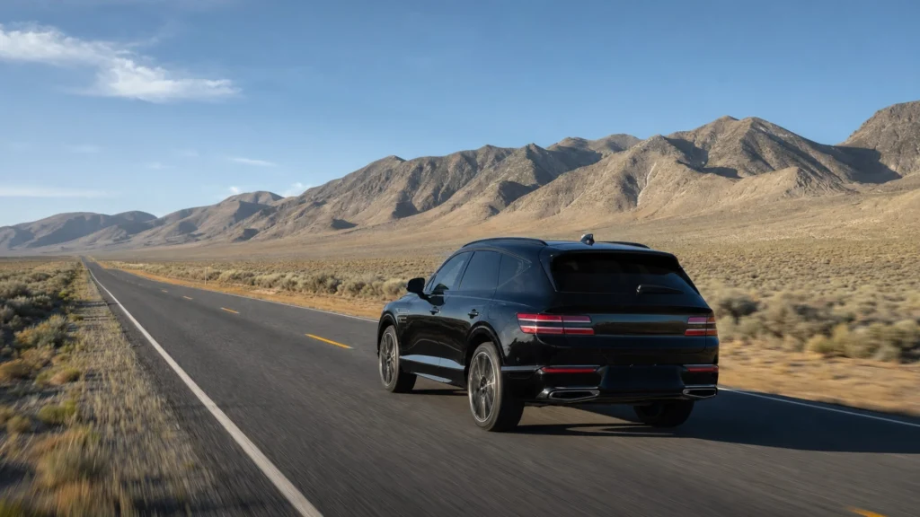
Quick answer: Reno is about 450 miles from Las Vegas, roughly a 7 hour drive straight up US Highway 95 through the heart of Nevada. Or skip the road entirely: a nonstop flight is about 1 hour 25 minutes. Both cities sit in Nevada, but they are on opposite ends of the state, so this is a real journey, not a quick hop.
Almost everyone who searches “how far is Reno from Las Vegas” is really deciding one thing: drive or fly. The honest answer is that Reno is one of the longest trips you can take without leaving Nevada, about 450 miles and seven hours by car, or a 90-minute nonstop by plane. Neither is wrong. The drive is a genuine desert road trip past ghost towns, mining camps, and open-air art; the flight gets you there before lunch. This guide gives you the exact distance, the route and its best stops, whether a day trip is possible, and the most comfortable way to make the trip for your group.
- Distance: about 450 miles by road from Las Vegas to Reno, roughly a 7 hour drive up US-95 north.
- By air: only about 345 miles apart, a nonstop flight of about 1 hour 25 minutes, with 8 to 13 nonstops most days.
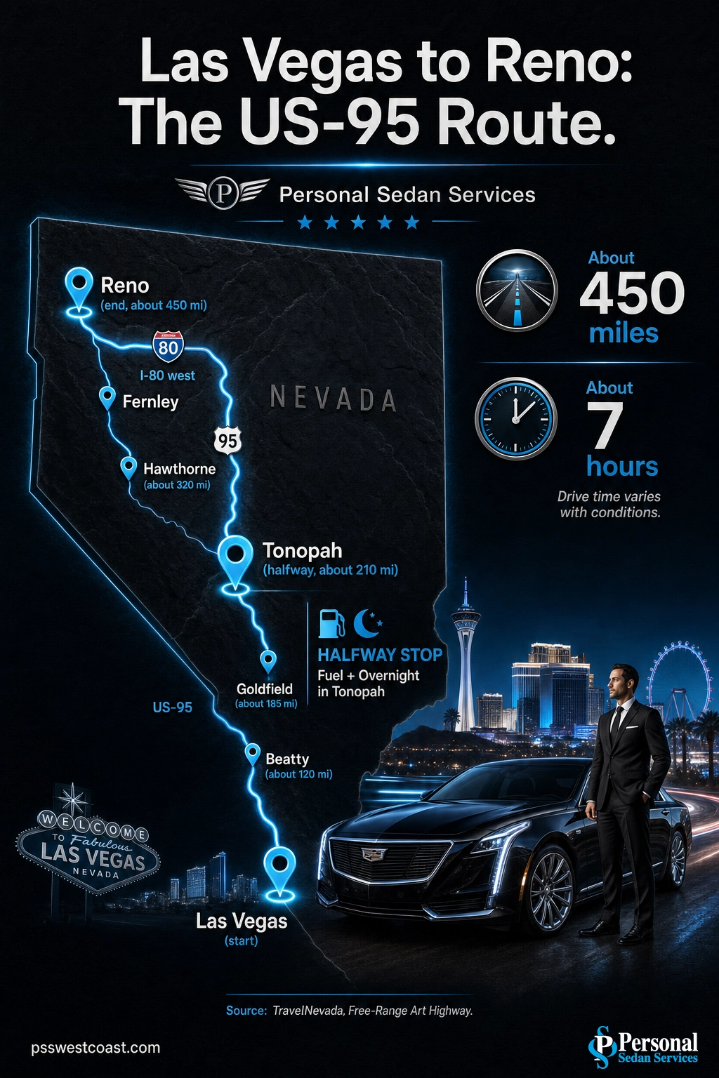
- The route: US Highway 95 north for roughly 400 miles to Fernley, then Interstate 80 west the last 35 miles into Reno.
- Farther than Los Angeles: Reno is a longer drive from Las Vegas than Los Angeles or San Diego, a fact that surprises most first-timers.
- Not a day trip by car: a round trip is about 900 miles and 14 hours of driving. Same-day is only realistic by plane.
- Best stops: Beatty and Rhyolite, Goldfield’s Car Forest, Tonopah at the halfway mark, and Hawthorne on Walker Lake.
- For groups and events, a private chauffeured vehicle turns the long haul into door-to-door travel where everyone arrives together and rested.
What’s in This Guide
- How Far Is Reno from Las Vegas, Exactly?
- How Reno Compares to Other Trips from Las Vegas
- Ways to Get from Las Vegas to Reno
- The Drive: Best Route and What to Expect
- Best Stops Along the Way
- Can You Do Reno as a Day Trip from Las Vegas?
- Skip the Drive: Let Us Take You
- Reno Travel FAQ
- Related Las Vegas Travel Guides
How Far Is Reno from Las Vegas, Exactly?
From downtown Las Vegas to downtown Reno, the driving distance is about 450 miles and the drive takes roughly seven hours without long stops. The entire trip runs almost dead north up US Highway 95, the two-lane desert corridor that connects Nevada’s south to its north, before a short jog west on Interstate 80 into Reno. By air the gap is smaller, about 345 miles, because a plane cuts straight across while the highway threads between mountain ranges.
The reason the two numbers differ so much is geography. Las Vegas sits in the far south of Nevada and Reno sits in the far northwest, near the California line and Lake Tahoe. They are the state’s two largest cities, but they are about as far apart as Nevada allows. That is why locals treat Vegas and Reno as separate trips entirely, not a casual overnight.

Distances and drive times are approximate and reflect Google Maps directions from Las Vegas. Your real number will shift with traffic leaving the valley, weather in the higher desert, and how many of the towns along US-95 you stop to explore.
Source: TravelNevada Free-Range Art Highway route
See our luxury transportation options
How Reno Compares to Other Trips from Las Vegas
Numbers only mean so much in isolation, so it helps to place Reno next to the trips Las Vegas travelers already know. Pahrump and Laughlin are quick runs. Death Valley is an easy day trip. Even Salt Lake City, which feels far, is shorter than Reno. Against that backdrop, Reno stands out as one of the longest in-state drives you can make.
The Nevada myth to drop: Because Las Vegas and Reno are both in Nevada, people assume the drive is short. It is not. At about 450 miles, Reno is a longer drive from Las Vegas than Los Angeles (about 270 miles) or San Diego (about 330 miles). Plan Reno like the cross-state trip it is, with fuel, food, and rest stops mapped out, not like a spur-of-the-moment overnight.
Source: TravelNevada Las Vegas to Reno road trip
Ways to Get from Las Vegas to Reno
There are five realistic ways to cover the distance. None is the single right answer; the best choice depends on your group size, your schedule, and whether the road trip itself is part of the plan. Here is the honest comparison.
| Option | Time (one way) | Rough cost | Best for |
|---|---|---|---|
| Drive yourself | ~7 hrs | ~$60–90 in gas | Road-trippers who want the desert-art towns and full flexibility |
| Fly nonstop | ~1 hr 25 min in the air | ~$60–150+ per person | Speed, solo or couple travel, same-day turnarounds |
| Scheduled intercity bus | ~9–11 hrs | Budget fares | Lowest cost when time is not a concern |
| Private chauffeured car (us) | ~7 hrs, you never drive | Per-trip quote | Groups and events wanting door-to-door comfort, no rental, everyone together |
| Group charter (us) | ~7–8 hrs | Per-group quote | Large parties, teams, and wedding or event groups traveling as one |
For most people flying wins on pure speed, and it is why the airlines run 8 to 13 nonstops between the two cities on a typical day. But flying strips out everything that makes the overland trip memorable, and it adds rental cars, bag limits, and airport time on both ends. If you are moving a group, or you want the journey to be part of the experience, the road options are worth a serious look. When you do fly, a private car waiting at Harry Reid means the Las Vegas end of the trip is handled the moment you land.
Arrange your Harry Reid airport pickup
Source: Reno-Tahoe International Airport nonstop destinations
The Drive: Best Route and What to Expect
The route is refreshingly simple: US Highway 95 north for roughly 400 miles to the town of Fernley, then Interstate 80 west for the final 35 miles or so into Reno. Nevada’s tourism board brands this stretch of US-95 the “Free-Range Art Highway” for the roadside sculptures and quirky towns strung along it. There are no complicated interchanges to memorize; you point the car north and stay on 95 for most of the day.
What to actually expect: long, open, high-desert two-lane highway with wide gaps between towns. This is beautiful driving, but it is remote. Cell coverage drops out for long stretches, gas stations are spaced far apart, and the elevation climbs as you go north, so weather can change. In winter, storms can bring snow to the higher passes around Tonopah and near Reno, occasionally slowing or closing sections of road.
Fuel and timing tips for US-95: Fill the tank in Las Vegas and top off again in Beatty and Tonopah, the two most reliable fuel stops. Carry water and snacks, since services thin out between towns. Leave early so you reach Reno in daylight, and in the colder months check road and pass conditions before you go, as high-desert storms can appear quickly.
Source: TravelNevada US-95 route and towns
Best Stops Along the Way
The seven-hour drive is far more enjoyable if you treat the towns along US-95 as the point rather than the obstacle. These four are genuinely worth the pause, listed roughly in the order you reach them heading north.
Beatty and Rhyolite (about 120 miles in)
Beatty is the first real town, a small high-desert stop known for wild burros that wander the streets. Just outside it sits Rhyolite, one of Nevada’s most photogenic ghost towns, alongside the Goldwell Open Air Museum and its ghostly life-size sculptures. It is the natural first leg-stretch and fuel stop.
Goldfield and the Car Forest (about 185 miles in)
Once the biggest city in Nevada during its early-1900s gold rush, Goldfield is now a near-ghost town with grand old buildings still standing. The must-see here is the International Car Forest of the Last Church, an outdoor art installation of graffiti-covered cars planted nose-down in the desert, one of the signature stops on the Free-Range Art Highway.
Tonopah, the halfway mark (about 210 miles in)
Tonopah is the classic midpoint and the best place to break the drive, roughly three and a half hours from Las Vegas. This historic silver-mining town is famous for some of the darkest night skies in the country, making it a renowned stargazing stop, plus the Tonopah Historic Mining Park and the offbeat Clown Motel. If you split the trip over two days, Tonopah is where most travelers overnight.
Hawthorne and Walker Lake (about 320 miles in)
Farther north, Hawthorne sits beside Walker Lake, a rare stretch of blue in the high desert and a welcome change of scenery. The town is home to a large Army ammunition depot, its bunkers dotting the valley, and the Hawthorne Ordnance Museum. From here it is a final push to Fernley and the turn west toward Reno.

Source: TravelNevada Free-Range Art Highway stops
Can You Do Reno as a Day Trip from Las Vegas?
By car, no. The math makes it clear: a round trip is about 900 miles and roughly 14 hours of driving, before you spend a single minute in Reno. Even the most determined road-tripper cannot turn that into a same-day out-and-back. Reno is an overnight destination at the very least, and it pairs naturally with a two or three day road trip that uses the US-95 towns as stops.
The only same-day option is flying. A nonstop is about 90 minutes each way, so it is physically possible to fly up in the morning, spend the afternoon in Reno or at Lake Tahoe an hour beyond it, and fly back that night. It is a full, tightly scheduled day, but it works, which is exactly why the air route is so busy.
If you want the road trip experience without losing two full days to driving, the comfortable middle path is to be driven one way and fly the other, or to split the group’s travel between a private vehicle and a flight. However you plan it, treat Reno as a trip that deserves at least one overnight.
Skip the Drive: Let Us Take You
Seven hours behind the wheel on a remote desert highway is a lot to ask of one driver, especially for a group heading to a wedding, a reunion, a corporate event, or a Lake Tahoe getaway. The whole point of the trip gets lost when one person arrives exhausted and everyone else spent the day cramped in a rental. That is the gap a private chauffeured ride fills.
With Personal Sedan Services, a professional, licensed, background-checked chauffeur handles every mile in a luxury sedan, SUV, or Sprinter van. Your group travels together, stops in Beatty or Tonopah when it wants, and arrives in Reno rested instead of road-weary, with no rental counter, no fuel stops to manage, and no one drawing the short straw to drive. For larger parties, a group vehicle built for the distance keeps everyone in one place, and our professional chauffeurs know these long Nevada routes. If you fly instead, we handle the Las Vegas end, meeting you at Harry Reid so the trip starts and finishes in comfort.
Book your Reno trip transportation
Reno Travel FAQ
How far is Reno from Las Vegas?
How long is the drive from Las Vegas to Reno?
Can you do Reno as a day trip from Las Vegas?
Is it better to drive or fly from Las Vegas to Reno?
What is the best route from Las Vegas to Reno?
Related Las Vegas Travel Guides
- Salt Lake City distance and route – the other long cross-state drive, on I-15 north.
- Barstow distance and drive time – the classic halfway stop toward California.
- Mesquite drive and route – a short hop northeast on I-15.
- Pahrump distance and getting there – the closest town on this list, about an hour out.
- Palm Springs distance and route – the desert-resort drive southwest.
- Laughlin drive and what to do – a river-town day trip south of the valley.
See our long-distance route service
Sources and Methodology
Driving distance and drive time reflect Google Maps directions between Las Vegas and Reno on US Highway 95, and are approximate; actual times vary with traffic, weather, road conditions, and stops. Route details, town descriptions, and stops come from TravelNevada, the official tourism board of the State of Nevada, which brands the US-95 corridor the Free-Range Art Highway. Nonstop flight time and airline service reflect scheduled nonstop service between Harry Reid International Airport and Reno-Tahoe International Airport. Comparison drive times to other destinations are approximate Google Maps figures. Fuel and fare figures are rough planning estimates, not quotes.